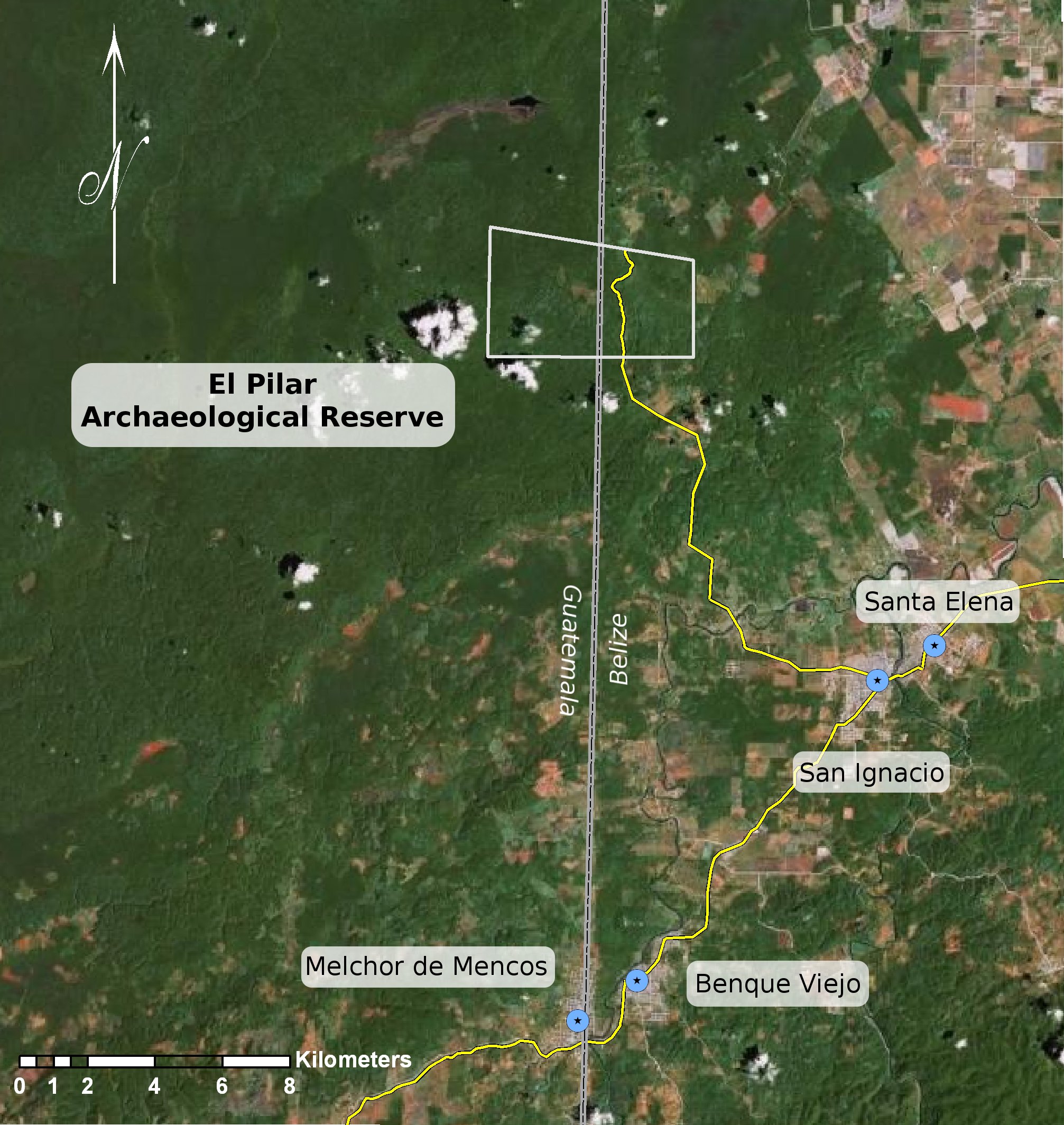
Various Departments and Research Centers at UCSB are using GIS (Geographic Information Systems) to address a variety of problems. Some geologists, for example, are studying the movement of crustal plates. Biologists are working with geographers to study environmental issues. A sociologist has used GIS to map inequality in the Los Angeles garment industry. Dr. Anabel Ford is using a revolutionary technology to the world of Archaeology, known as LiDAR, in conjunction with GIS to discover ancient structures previously hidden by the dense canopy of the Maya forest.
Predictive Model of Maya Settlements
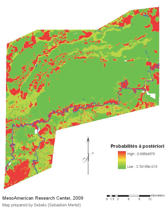
Modeling Settlement Patterns of the Late Classic Maya Civilization ~ Using GIS to predict Maya settlement
S. Merlet Thesis on GIS in Predictive Models